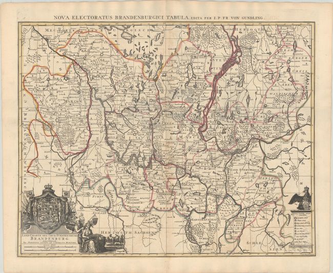
Title:
“Land-Charte des Chur-Furstenthums Brandenburg”
Map Maker:
Jean Covens & Corneille Mortier
Based on the work of Jacob Paul von Gundling, this... (full text available to subscribers)
| Item Detail |
| |
| |
MapMaker: |
Jean Covens & Corneille Mortier
|
|
| |
| |
Subject: |
Northeastern Germany & Northwestern Poland |
|
| |
Period/Size: |
1730 / 18.6" x 23.7" (47.3 x 60.2 cm)
|
|
| |
Color: |
Colored
|
|
| |
Condition: |
(B+) A fine impression with contemporary outline color. There is light toning and minor offsetting along the centerfold and a short centerfold separation in the bottom blank margin. A stamp from the Western Reserve Historical Society of Cleveland, OH ap (condition help) |
|
| |
Source: |
|
|
| |
References: |
|
|
| |
|
|
| Sales Information |
| |
| |
Price: |
|
|
| |
| |
Offered by: |
Old World Auctions |
|
| |
Catalog: |
Auction No. 186 - Antique Maps, Charts, Atlases & Globes (9551) |
|
| |
Lot/Item #: |
506 |
|
| |
| |
Date: |
02/2022
|
|
| |
| |
|
Antique Maps - Valuation and Pricing, Descriptions, Resources |
|
Home |
Information |
Search |
Register |
Contact Us |
Site Map
Americana Exchange, Inc. © 1999 - 2024 Americana Exchange, Inc.. All rights reserved.
OldMaps.com, the OldMaps.com logo and
AMPR are service marks or registered service marks of Americana Exchange, Inc..
|