| Item Detail |
| |
| |
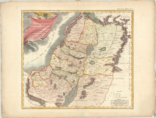
MapMaker: |
Pierre Mortier
|
|
| |
| |
Subject: |
Holy Land |
|
| |
Period/Size: |
1809 / 15.4" x 17.4" (39.2 x 44.2 cm)
|
|
| |
Color: |
Colored
|
|
| |
Condition: |
(B+) On a sturdy with a bunch of grapes watermark, with very light soiling, a few spots of foxing, and a small paper flaw within "Tribu de Nephtali." There is marginal toning and heavy soiling along the edges of the sheet, which are deckle-edged. (condition help) |
|
| |
Source: |
Nouvel Atlas de la Bible |
|
| |
References: |
|
|
| |
|
|
| Sales Information |
| |
| |
Price: |
|
|
| |
| |
Offered by: |
Old World Auctions |
|
| |
Catalog: |
Auction No. 186 - Antique Maps, Charts, Atlases & Globes (9551) |
|
| |
Lot/Item #: |
649 |
|
| |
| |
Date: |
02/2022
|
|
| |
| |
|