Title:
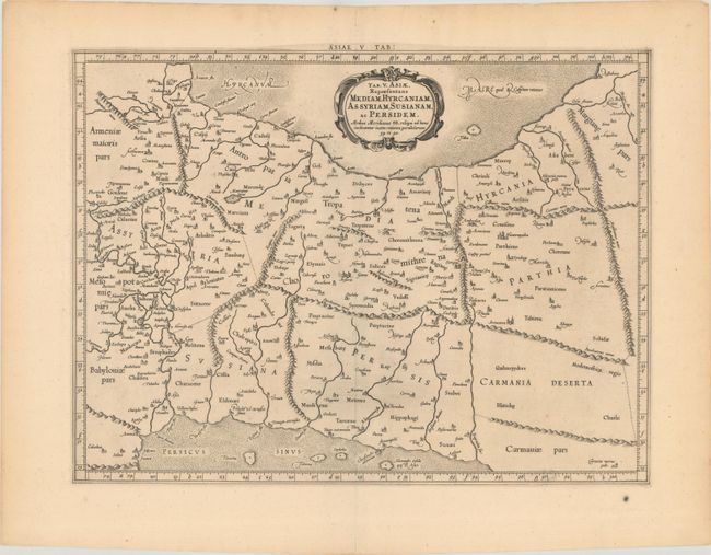
“Tab. V. Asiae, Repraesentans Mediam, Hyrcaniam, Assyriam, Susianam, ac Persidem...”
Map Maker:
Ptolemy/Mercator
Fine Ptolemaic map depicting much of modern-day Ir... (full text available to subscribers)
| Item Detail |
| |
| |
MapMaker: |
Ptolemy/Mercator
|
|
| |
| |
Subject: |
Persia - Iran |
|
| |
Period/Size: |
1698 / 13.6" x 18.0" (34.6 x 45.8 cm)
|
|
| |
Color: |
Black & White
|
|
| |
Condition: |
(A) A crisp impression on paper with a Strasburg Bend & Lily watermark, minor toning, and a small paper flaw in the bottom blank margin. (condition help) |
|
| |
Source: |
Claudii Ptolemaei Tabulae Geographicae Orbis Terrarum |
|
| |
References: |
Mickwitz & Miekkavaara #234-11; Van der Krogt (Vol. I) #0925:1.2. |
|
| |
|
|
| Sales Information |
| |
| |
Price: |
|
|
| |
| |
Offered by: |
Old World Auctions |
|
| |
Catalog: |
Auction No. 186 - Antique Maps, Charts, Atlases & Globes (9551) |
|
| |
Lot/Item #: |
655 |
|
| |
| |
Date: |
02/2022
|
|
| |
| |
|
Antique Maps - Valuation and Pricing, Descriptions, Resources |
|
Home |
Information |
Search |
Register |
Contact Us |
Site Map
Americana Exchange, Inc. © 1999 - 2024 Americana Exchange, Inc.. All rights reserved.
OldMaps.com, the OldMaps.com logo and
AMPR are service marks or registered service marks of Americana Exchange, Inc..
|