Title:
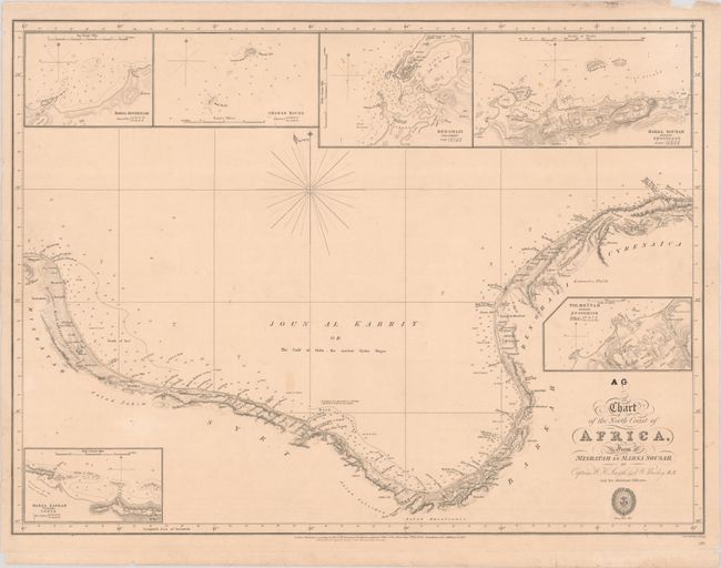
“Chart of the North Coast of Africa, from Misratah to Marsa Sousah”
Map Maker:
British Admiralty
This scarce chart from the Hydrographical Office o... (full text available to subscribers)
| Item Detail |
| |
| |
MapMaker: |
British Admiralty
|
|
| |
| |
Subject: |
Libya |
|
| |
Period/Size: |
1838 / 17.8" x 23.8" (45.3 x 60.5 cm)
|
|
| |
Color: |
Black & White
|
|
| |
Condition: |
(B+) On a slightly toned sheet with a few light spots and several short repaired edge tears in the margins, including one that crosses the neatline at top. (condition help) |
|
| |
Source: |
|
|
| |
References: |
|
|
| |
|
|
| Sales Information |
| |
| |
Price: |
|
|
| |
| |
Offered by: |
Old World Auctions |
|
| |
Catalog: |
Auction No. 186 - Antique Maps, Charts, Atlases & Globes (9551) |
|
| |
Lot/Item #: |
714 |
|
| |
| |
Date: |
02/2022
|
|
| |
| |
|
Antique Maps - Valuation and Pricing, Descriptions, Resources |
|
Home |
Information |
Search |
Register |
Contact Us |
Site Map
Americana Exchange, Inc. © 1999 - 2024 Americana Exchange, Inc.. All rights reserved.
OldMaps.com, the OldMaps.com logo and
AMPR are service marks or registered service marks of Americana Exchange, Inc..
|