| Item Detail |
| |
| |
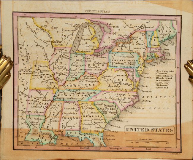
MapMaker: |
H.S. Tanner
|
|
| |
| |
Subject: |
Exploration & Surveys |
|
| |
Period/Size: |
1834 / 7.4" x 4.4" (18.8 x 11.2 cm)
|
|
| |
Color: |
Colored
|
|
| |
Condition: |
(B) The maps were printed on a bank-note style paper, and are moderately to heavily toned where they touched the sheets of text. For most of the maps, which are folding, this impacts only a strip of the map on recto. The text has scattered foxing. The (condition help) |
|
| |
Source: |
|
|
| |
References: |
Howes #B-45; Sabin #2594. |
|
| |
|
|
| Sales Information |
| |
| |
Price: |
|
|
| |
| |
Offered by: |
Old World Auctions |
|
| |
Catalog: |
Auction No. 186 - Antique Maps, Charts, Atlases & Globes (9551) |
|
| |
Lot/Item #: |
813 |
|
| |
| |
Date: |
02/2022
|
|
| |
| |
|