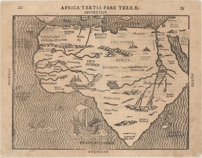
Title:
“Africa Tertia Pars Terrae”
Map Maker:
Heinrich Bunting
A very rare woodcut map of the continent with an u... (full text available to subscribers)
| Item Detail |
| |
| |
MapMaker: |
Heinrich Bunting
|
|
| |
| |
Subject: |
Africa |
|
| |
Period/Size: |
1600 / 11.0" x 13.8" (28.0 x 35.1 cm)
|
|
| |
Color: |
Black & White
|
|
| |
Condition: |
(B+) A dark impression with minor toning and light soiling that is mostly confined to the blank margins. There are archival repairs to some small chips along the bottom edge of the sheet. (condition help) |
|
| |
Source: |
Itinerarium Sacrae Scripturae |
|
| |
References: |
Betz #24.3; Norwich #17; Tooley (MCC-29) #141. |
|
| |
|
|
| Sales Information |
| |
| |
Price: |
|
|
| |
| |
Offered by: |
Old World Auctions |
|
| |
Catalog: |
Auction No. 187 - Antique Maps, Charts, Atlases & Globes (9557) |
|
| |
Lot/Item #: |
651 |
|
| |
| |
Date: |
02/2022
|
|
| |
| |
|
Antique Maps - Valuation and Pricing, Descriptions, Resources |
|
Home |
Information |
Search |
Register |
Contact Us |
Site Map
Americana Exchange, Inc. © 1999 - 2024 Americana Exchange, Inc.. All rights reserved.
OldMaps.com, the OldMaps.com logo and
AMPR are service marks or registered service marks of Americana Exchange, Inc..
|