| Item Detail |
| |
| |
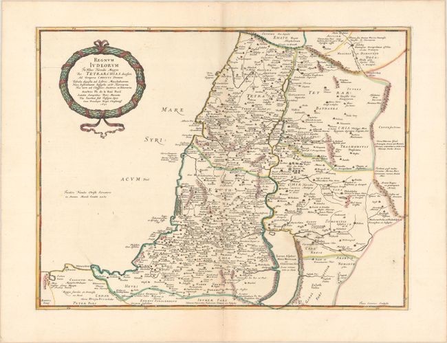
MapMaker: |
Philippe de la Rue
|
|
| |
| |
Subject: |
Holy Land |
|
| |
Period/Size: |
1651 / 15.9" x 20.9" (40.4 x 53.1 cm)
|
|
| |
Color: |
Colored
|
|
| |
Condition: |
(A) A dark impression with contemporary outline color in the map and later color in the cartouche, on a bright sheet with a large coat of arms watermark. There is a hint of toning along the centerfold, some soft creases along the centerfold at top, and t (condition help) |
|
| |
Source: |
La Terre Sainte en Six Cartes Geographiquesģ |
|
| |
References: |
Laor #418; Pastoureau, LA RUE [4]. |
|
| |
|
|
| Sales Information |
| |
| |
Price: |
|
|
| |
| |
Offered by: |
Old World Auctions |
|
| |
Catalog: |
Auction No. 187 - Antique Maps, Charts, Atlases & Globes (9557) |
|
| |
Lot/Item #: |
578 |
|
| |
| |
Date: |
02/2022
|
|
| |
| |
|