| Item Detail |
| |
| |
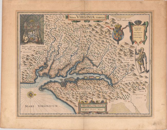
MapMaker: |
Hondius/Blaeu
|
|
| |
| |
Subject: |
Colonial Mid-Atlantic United States |
|
| |
Period/Size: |
1640 / 14.8" x 18.9" (37.6 x 48.0 cm)
|
|
| |
Color: |
Colored
|
|
| |
Condition: |
(B+) A nice impression on a lightly toned sheet with faint foxing, marginal soiling, and mat burn outside the image. There is an archivally repaired tear in the top blank margin and remnants of paper tape along the top edge of the sheet on verso. (condition help) |
|
| |
Source: |
Theatrum Orbis Terrarum |
|
| |
References: |
Burden #193; Portinaro & Knirsch KXXIV; Tooley (Amer) p. 161-62; Van der Krogt (Vol. II) #9410:2.2. |
|
| |
|
|
| Sales Information |
| |
| |
Price: |
|
|
| |
| |
Offered by: |
Old World Auctions |
|
| |
Catalog: |
Auction No. 187 - Antique Maps, Charts, Atlases & Globes (9557) |
|
| |
Lot/Item #: |
177 |
|
| |
| |
Date: |
02/2022
|
|
| |
| |
|