| Item Detail |
| |
| |
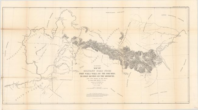
MapMaker: |
U.S. War Department
|
|
| |
| |
Subject: |
Northwestern United States |
|
| |
Period/Size: |
1863 / 17.6" x 33.9" (44.7 x 86.1 cm)
|
|
| |
Color: |
Black & White
|
|
| |
Condition: |
(B+) Issued folding and now flattened and backed with tissue to reinforce and repair several tiny fold separations. There is light toning along the fold lines. (condition help) |
|
| |
Source: |
Sen. Doc. 43, 37th Congress, 3rd Session |
|
| |
References: |
Wheat (TMW) #1080; Wagner-Camp #393. |
|
| |
|
|
| Sales Information |
| |
| |
Price: |
|
|
| |
| |
Offered by: |
Old World Auctions |
|
| |
Catalog: |
Auction No. 187 - Antique Maps, Charts, Atlases & Globes (9557) |
|
| |
Lot/Item #: |
208 |
|
| |
| |
Date: |
02/2022
|
|
| |
| |
|