| Item Detail |
| |
| |
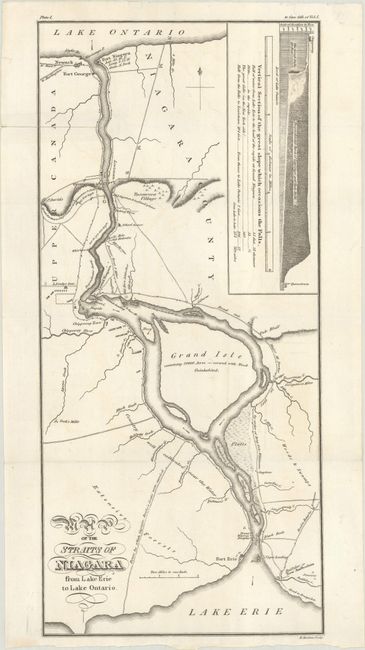
MapMaker: |
(none given)
|
|
| |
| |
Subject: |
Niagara Falls |
|
| |
Period/Size: |
1818 / 15.0" x 6.9" (38.1 x 17.6 cm)
|
|
| |
Color: |
Black & White
|
|
| |
Condition: |
(B+) A crisp impression issued folding with faint offsetting and a 2.5" fold separation at top left that has been closed on verso with tape. (condition help) |
|
| |
Source: |
A Full and Correct Account of the Military Occurrences of the Late War... |
|
| |
References: |
Phillips (Maps) p. 549. |
|
| |
|
|
| Sales Information |
| |
| |
Price: |
|
|
| |
| |
Offered by: |
Old World Auctions |
|
| |
Catalog: |
Auction No. 187 - Antique Maps, Charts, Atlases & Globes (9557) |
|
| |
Lot/Item #: |
138 |
|
| |
| |
Date: |
02/2022
|
|
| |
| |
|