Title:
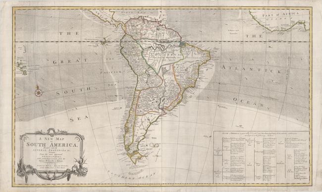
“A New Map of South America, Divided Into Its Several Provinces &c, Drawn from the Most Approved Geographers, with Improvements from the Sieurs D'Anville & Robert”
Map Maker:
Robert Sayer
This uncommon two-sheet map of South America is ba... (full text available to subscribers)
| Item Detail |
| |
| |
MapMaker: |
Robert Sayer
|
|
| |
| |
Subject: |
South America |
|
| |
Period/Size: |
1760 / 22.5" x 37.4" (57.2 x 95.0 cm)
|
|
| |
Color: |
Colored
|
|
| |
Condition: |
(B+) A nice impression with contemporary outline color on bright sheets with light printer's ink residue. Professionally backed in archival tissue to repair a 3" tear adjacent to the Salomon Islands, a 6" and an 8" tear adjacent to the title cartouche, t (condition help) |
|
| |
Source: |
|
|
| |
References: |
|
|
| |
|
|
| Sales Information |
| |
| |
Price: |
|
|
| |
| |
Offered by: |
Old World Auctions |
|
| |
Catalog: |
Auction No. 187 - Antique Maps, Charts, Atlases & Globes (9557) |
|
| |
Lot/Item #: |
330 |
|
| |
| |
Date: |
02/2022
|
|
| |
| |
|
Antique Maps - Valuation and Pricing, Descriptions, Resources |
|
Home |
Information |
Search |
Register |
Contact Us |
Site Map
Americana Exchange, Inc. © 1999 - 2024 Americana Exchange, Inc.. All rights reserved.
OldMaps.com, the OldMaps.com logo and
AMPR are service marks or registered service marks of Americana Exchange, Inc..
|