Title:
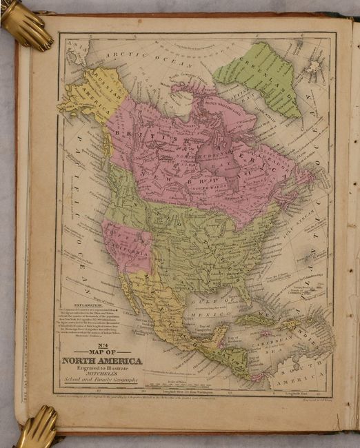
“Mitchell's School Atlas: Comprising the Maps, Etc., Designed to Illustrate Mitchell's School and Family Geography”
Map Maker:
Samuel Augustus Mitchell
Mitchell's famous school atlas is complete with 28... (full text available to subscribers)
| Item Detail |
| |
| |
MapMaker: |
Samuel Augustus Mitchell
|
|
| |
| |
Subject: |
Atlases |
|
| |
Period/Size: |
1846 / 12.1" x 9.8" (30.8 x 24.9 cm)
|
|
| |
Color: |
Colored
|
|
| |
Condition: |
(B) The maps are good to very good with light toning and soiling, and minor foxing. The map of the United States is a bit loose and has a 2" centerfold separation at bottom. The binding is shaken and the boards are heavily worn and soiled as is usually (condition help) |
|
| |
Source: |
|
|
| |
References: |
|
|
| |
|
|
| Sales Information |
| |
| |
Price: |
|
|
| |
| |
Offered by: |
Old World Auctions |
|
| |
Catalog: |
Auction No. 187 - Antique Maps, Charts, Atlases & Globes (9557) |
|
| |
Lot/Item #: |
738 |
|
| |
| |
Date: |
02/2022
|
|
| |
| |
|
Antique Maps - Valuation and Pricing, Descriptions, Resources |
|
Home |
Information |
Search |
Register |
Contact Us |
Site Map
Americana Exchange, Inc. © 1999 - 2024 Americana Exchange, Inc.. All rights reserved.
OldMaps.com, the OldMaps.com logo and
AMPR are service marks or registered service marks of Americana Exchange, Inc..
|