Title:
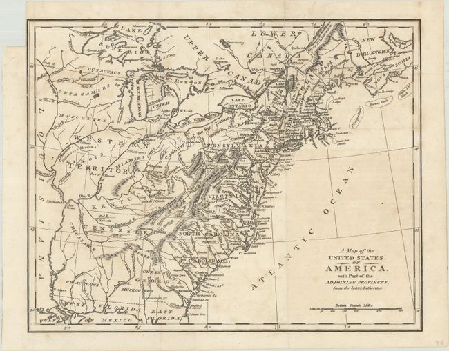
“A Map of the United States, of America, with Part of the Adjoining Provinces, from the Latest Authorities”
Map Maker:
anonymous
This map covers the region from the eastern seaboa... (full text available to subscribers)
| Item Detail |
| |
| |
MapMaker: |
anonymous
|
|
| |
| |
Subject: |
Eastern United States |
|
| |
Period/Size: |
1810 / 8.4" x 10.6" (21.4 x 27.0 cm)
|
|
| |
Color: |
Black & White
|
|
| |
Condition: |
(B+) A crisp impression, issued folding with light foxing and offsetting. There is a fold separation at top that has been closed on verso with archival tape and a binding trim that extends to the neatline at left. (condition help) |
|
| |
Source: |
|
|
| |
References: |
|
|
| |
|
|
| Sales Information |
| |
| |
Price: |
|
|
| |
| |
Offered by: |
Old World Auctions |
|
| |
Catalog: |
Auction No. 187 - Antique Maps, Charts, Atlases & Globes (9557) |
|
| |
Lot/Item #: |
159 |
|
| |
| |
Date: |
02/2022
|
|
| |
| |
|
Antique Maps - Valuation and Pricing, Descriptions, Resources |
|
Home |
Information |
Search |
Register |
Contact Us |
Site Map
Americana Exchange, Inc. © 1999 - 2024 Americana Exchange, Inc.. All rights reserved.
OldMaps.com, the OldMaps.com logo and
AMPR are service marks or registered service marks of Americana Exchange, Inc..
|