Title:
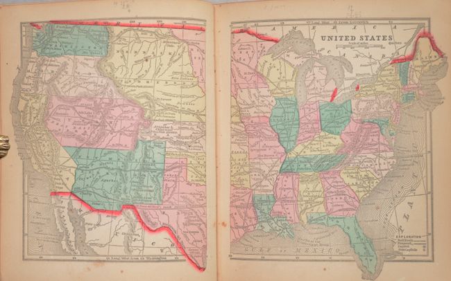
“The Diamond Atlas. With Descriptions of All Countries: Exhibiting Their Actual and Comparative Extent, and Their Present Political Divisions... The Western Hemisphere”
Map Maker:
Morse & Gaston
This is the very desirable edition of this small a... (full text available to subscribers)
| Item Detail |
| |
| |
MapMaker: |
Morse & Gaston
|
|
| |
| |
Subject: |
Atlases |
|
| |
Period/Size: |
1857 / 7.6" x 6.4" (19.3 x 16.3 cm)
|
|
| |
Color: |
Colored
|
|
| |
Condition: |
(B+) The condition code is for the maps, which are lightly toned with occasional soiling and pencil marks. The text is also lightly toned with minor soiling. The front cover and first signature are detached. The covers are lightly worn and abraded and (condition help) |
|
| |
Source: |
|
|
| |
References: |
|
|
| |
|
|
| Sales Information |
| |
| |
Price: |
|
|
| |
| |
Offered by: |
Old World Auctions |
|
| |
Catalog: |
Auction No. 187 - Antique Maps, Charts, Atlases & Globes (9557) |
|
| |
Lot/Item #: |
739 |
|
| |
| |
Date: |
02/2022
|
|
| |
| |
|
Antique Maps - Valuation and Pricing, Descriptions, Resources |
|
Home |
Information |
Search |
Register |
Contact Us |
Site Map
Americana Exchange, Inc. © 1999 - 2024 Americana Exchange, Inc.. All rights reserved.
OldMaps.com, the OldMaps.com logo and
AMPR are service marks or registered service marks of Americana Exchange, Inc..
|