Title:
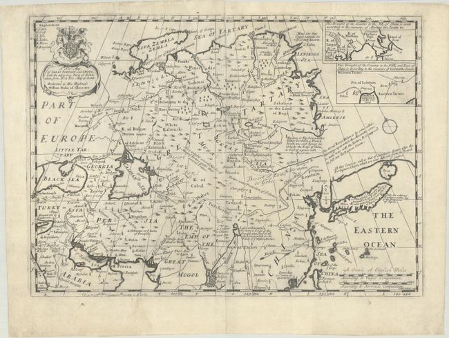
“A New Map of Great Tartary, and China, with the Adjoyning Parts of Asia, Taken from Mr. de Fer's Map of Asia”
Map Maker:
Edward Wells
This interesting English map covers from the Black... (full text available to subscribers)
| Item Detail |
| |
| |
MapMaker: |
Edward Wells
|
|
| |
| |
Subject: |
Eastern & Northern Asia |
|
| |
Period/Size: |
1701 / 14.2" x 19.8" (36.1 x 50.3 cm)
|
|
| |
Color: |
Black & White
|
|
| |
Condition: |
(B+) A dark impression on a sheet that has been backed with tissue to repair a 4" centerfold separation at top. Several small edge tears in the top blank margin have also been archivally repaired. (condition help) |
|
| |
Source: |
A New Set of Maps Both of Antient and Present Geography |
|
| |
References: |
Shirley (BL Atlases) T.WELL-1a #29. |
|
| |
|
|
| Sales Information |
| |
| |
Price: |
|
|
| |
| |
Offered by: |
Old World Auctions |
|
| |
Catalog: |
Auction No. 187 - Antique Maps, Charts, Atlases & Globes (9557) |
|
| |
Lot/Item #: |
610 |
|
| |
| |
Date: |
02/2022
|
|
| |
| |
|
Antique Maps - Valuation and Pricing, Descriptions, Resources |
|
Home |
Information |
Search |
Register |
Contact Us |
Site Map
Americana Exchange, Inc. © 1999 - 2024 Americana Exchange, Inc.. All rights reserved.
OldMaps.com, the OldMaps.com logo and
AMPR are service marks or registered service marks of Americana Exchange, Inc..
|