Title:
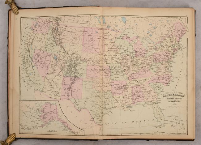
“Asher & Adams' New Statistical and Topographical Atlas of the United States. With Maps Showing the Dominion of Canada, Europe and the World...”
Map Maker:
Asher & Adams
This large-format atlas of the United States conta... (full text available to subscribers)
| Item Detail |
| |
| |
MapMaker: |
Asher & Adams
|
|
| |
| |
Subject: |
Atlases |
|
| |
Period/Size: |
1872 / 18.0" x 13.0" (45.8 x 33.1 cm)
|
|
| |
Color: |
Colored
|
|
| |
Condition: |
(B+) The maps are mostly clean and bright with some occasional foxing in the back half of the atlas. A small chip in the bottom margin of the Missouri map does not enter the image. There is some dampstaining along the gutter and bottom edge of the title (condition help) |
|
| |
Source: |
|
|
| |
References: |
|
|
| |
|
|
| Sales Information |
| |
| |
Price: |
|
|
| |
| |
Offered by: |
Old World Auctions |
|
| |
Catalog: |
Auction No. 187 - Antique Maps, Charts, Atlases & Globes (9557) |
|
| |
Lot/Item #: |
741 |
|
| |
| |
Date: |
02/2022
|
|
| |
| |
|
Antique Maps - Valuation and Pricing, Descriptions, Resources |
|
Home |
Information |
Search |
Register |
Contact Us |
Site Map
Americana Exchange, Inc. © 1999 - 2024 Americana Exchange, Inc.. All rights reserved.
OldMaps.com, the OldMaps.com logo and
AMPR are service marks or registered service marks of Americana Exchange, Inc..
|