| Item Detail |
| |
| |
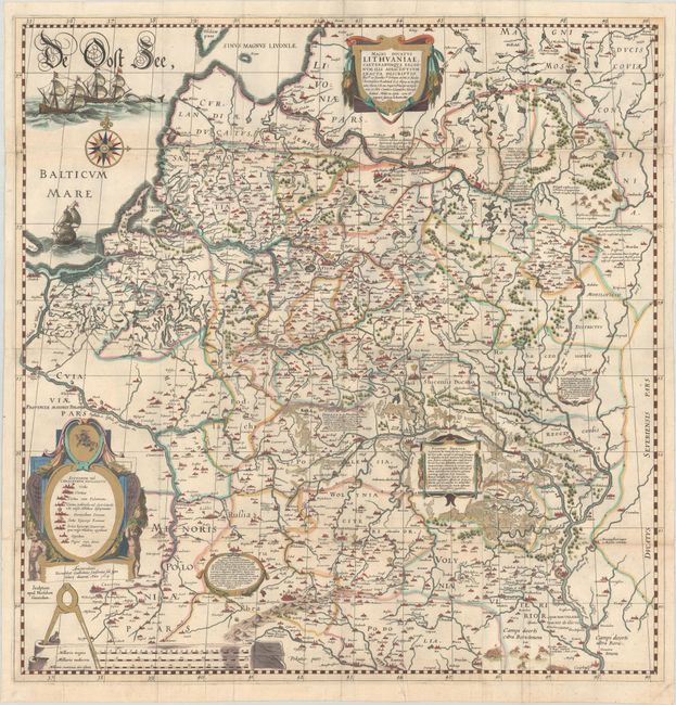
MapMaker: |
Willem Blaeu
|
|
| |
| |
Subject: |
Eastern Europe, Lithuania & Ukraine |
|
| |
Period/Size: |
1634 / 29.6" x 28.9" (75.2 x 73.4 cm)
|
|
| |
Color: |
Colored
|
|
| |
Condition: |
(B) A sharp impression with gilt highlights, issued folding with a light stain near center. There is a strip along the horizontal fold at top, measuring around 0.25 - 0.5" in width, that has been replaced in facsimile. There are archival repairs to a fe (condition help) |
|
| |
Source: |
|
|
| |
References: |
Ukraine in Old Maps pp. 184-87; Van der Krogt (Vol. II) #1730/I:2A. |
|
| |
|
|
| Sales Information |
| |
| |
Price: |
|
|
| |
| |
Offered by: |
Old World Auctions |
|
| |
Catalog: |
Auction No. 187 - Antique Maps, Charts, Atlases & Globes (9557) |
|
| |
Lot/Item #: |
499 |
|
| |
| |
Date: |
02/2022
|
|
| |
| |
|