Title:
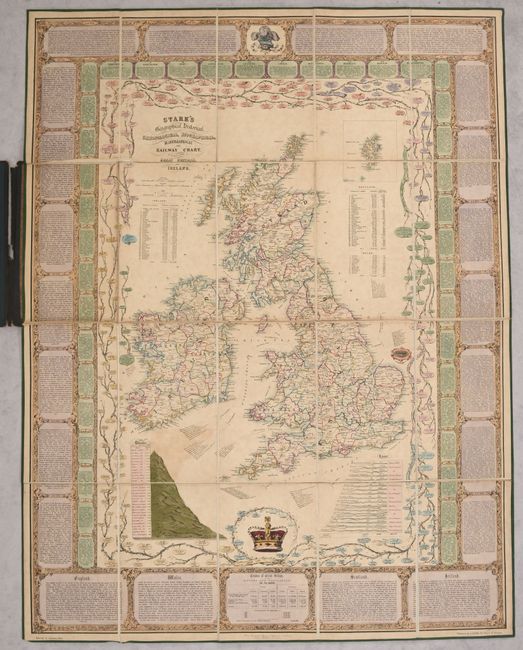
“Stark's Geographical, Historical, Chronological, Biographical, Mineralogical and Railway Chart, of the United Kingdom of Great Britain, and Ireland”
This attractive folding map gives extensive inform... (full text available to subscribers)
| Item Detail |
| |
| |
MapMaker: |
(none given)
|
|
| |
| |
Subject: |
Britain |
|
| |
Period/Size: |
1851 / 38.9" x 29.8" (98.8 x 75.7 cm)
|
|
| |
Color: |
Colored
|
|
| |
Condition: |
(B+) Full contemporary color with light soiling and some color offsetting. The covers are moderately worn with bumped corners and several tears and chips along the spine. (condition help) |
|
| |
Source: |
|
|
| |
References: |
|
|
| |
|
|
| Sales Information |
| |
| |
Price: |
|
|
| |
| |
Offered by: |
Old World Auctions |
|
| |
Catalog: |
Auction No. 187 - Antique Maps, Charts, Atlases & Globes (9557) |
|
| |
Lot/Item #: |
390 |
|
| |
| |
Date: |
02/2022
|
|
| |
| |
|
Antique Maps - Valuation and Pricing, Descriptions, Resources |
|
Home |
Information |
Search |
Register |
Contact Us |
Site Map
Americana Exchange, Inc. © 1999 - 2024 Americana Exchange, Inc.. All rights reserved.
OldMaps.com, the OldMaps.com logo and
AMPR are service marks or registered service marks of Americana Exchange, Inc..
|