Title:
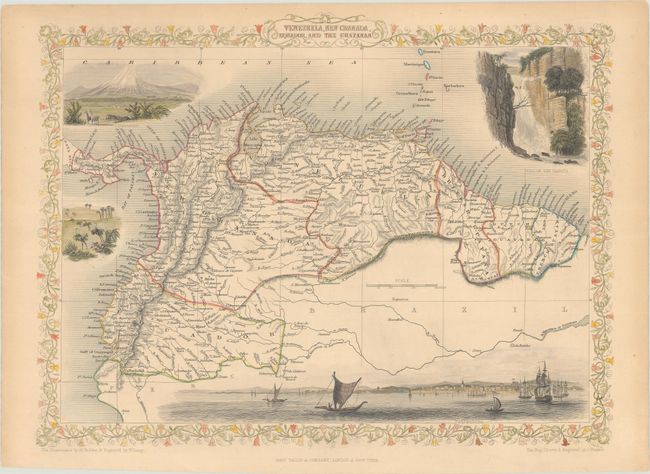
“Venezuela, New Granada, Equador, and the Guayanas”
Map Maker:
John Tallis
This beautiful and finely engraved steel plate map... (full text available to subscribers)
| Item Detail |
| |
| |
MapMaker: |
John Tallis
|
|
| |
| |
Subject: |
Northern South America |
|
| |
Period/Size: |
1850 / 9.8" x 13.0" (24.9 x 33.1 cm)
|
|
| |
Color: |
Colored
|
|
| |
Condition: |
(B+) On a slightly toned sheet with contemporary outline color and later color in the vignettes and border. There is a short edge tear in the right blank margin. (condition help) |
|
| |
Source: |
Illustrated Atlas and Modern History of the World |
|
| |
References: |
|
|
| |
|
|
| Sales Information |
| |
| |
Price: |
|
|
| |
| |
Offered by: |
Old World Auctions |
|
| |
Catalog: |
Auction No. 187 - Antique Maps, Charts, Atlases & Globes (9557) |
|
| |
Lot/Item #: |
333 |
|
| |
| |
Date: |
02/2022
|
|
| |
| |
|
Antique Maps - Valuation and Pricing, Descriptions, Resources |
|
Home |
Information |
Search |
Register |
Contact Us |
Site Map
Americana Exchange, Inc. © 1999 - 2024 Americana Exchange, Inc.. All rights reserved.
OldMaps.com, the OldMaps.com logo and
AMPR are service marks or registered service marks of Americana Exchange, Inc..
|