| Item Detail |
| |
| |
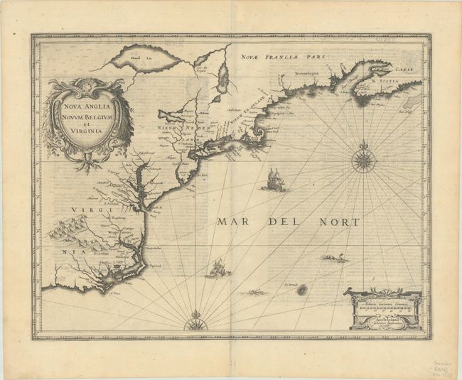
MapMaker: |
Jan Jansson
|
|
| |
| |
Subject: |
Colonial New England & Mid-Atlantic United States |
|
| |
Period/Size: |
1636 / 15.3" x 19.9" (38.9 x 50.6 cm)
|
|
| |
Color: |
Black & White
|
|
| |
Condition: |
(B+) A dark impression with show-through of text on verso and a short tear in the bottom blank margin. (condition help) |
|
| |
Source: |
Appendix Atlantis |
|
| |
References: |
Burden #247; Cumming (SE) #39; Karpinski, p. 26 & 31 plt. II; McCorkle #636.2; Van der Krogt (Vol. I) #9310:1A.1. |
|
| |
|
|
| Sales Information |
| |
| |
Price: |
|
|
| |
| |
Offered by: |
Old World Auctions |
|
| |
Catalog: |
Auction No. 187 - Antique Maps, Charts, Atlases & Globes (9557) |
|
| |
Lot/Item #: |
167 |
|
| |
| |
Date: |
02/2022
|
|
| |
| |
|