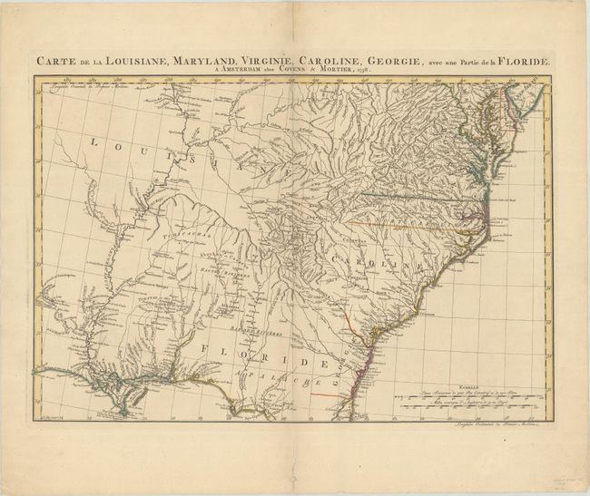
Title:
“Carte de la Louisiane, Maryland, Virginie, Caroline, Georgie, avec une Partie de la Floride”
Map Maker:
Jean Covens & Corneille Mortier
This rare and detailed map of the Southeast covers... (full text available to subscribers)
| Item Detail |
| |
| |
MapMaker: |
Jean Covens & Corneille Mortier
|
|
| |
| |
Subject: |
Colonial Southeast United States |
|
| |
Period/Size: |
1758 / 15.4" x 23.1" (39.2 x 58.7 cm)
|
|
| |
Color: |
Colored
|
|
| |
Condition: |
(A) A nice impression with contemporary outline color on a sturdy sheet with a "C&I Honig" watermark and a hint of toning. There are centerfold separations in the top and bottom blank margins that have been closed on verso with archival tape. (condition help) |
|
| |
Source: |
Atlas Nouveau |
|
| |
References: |
Cumming (SE) #316; Sellers and Van Ee #1386. |
|
| |
|
|
| Sales Information |
| |
| |
Price: |
|
|
| |
| |
Offered by: |
Old World Auctions |
|
| |
Catalog: |
Auction No. 187 - Antique Maps, Charts, Atlases & Globes (9557) |
|
| |
Lot/Item #: |
192 |
|
| |
| |
Date: |
02/2022
|
|
| |
| |
|
Antique Maps - Valuation and Pricing, Descriptions, Resources |
|
Home |
Information |
Search |
Register |
Contact Us |
Site Map
Americana Exchange, Inc. © 1999 - 2024 Americana Exchange, Inc.. All rights reserved.
OldMaps.com, the OldMaps.com logo and
AMPR are service marks or registered service marks of Americana Exchange, Inc..
|