| Item Detail |
| |
| |
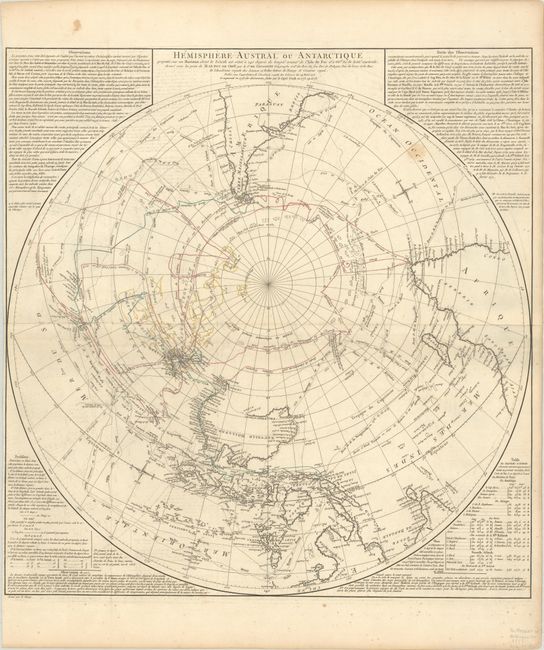
MapMaker: |
Didier Robert de Vaugondy
|
|
| |
| |
Subject: |
South Pole |
|
| |
Period/Size: |
1777 / 25.4" x 24.4" (64.6 x 62.0 cm)
|
|
| |
Color: |
Colored
|
|
| |
Condition: |
(B+) Contemporary outline color on a bright sheet with a large eagle watermark, issued folding with light soiling and offsetting, a bit of scattered foxing mostly confined to the bottom blank margin, and a 1.5" fold separation at left that has been closed (condition help) |
|
| |
Source: |
|
|
| |
References: |
Pedley #27; Tooley (Australia) #1004; Tooley (MCC-2) #73. |
|
| |
|
|
| Sales Information |
| |
| |
Price: |
|
|
| |
| |
Offered by: |
Old World Auctions |
|
| |
Catalog: |
Auction No. 187 - Antique Maps, Charts, Atlases & Globes (9557) |
|
| |
Lot/Item #: |
47 |
|
| |
| |
Date: |
02/2022
|
|
| |
| |
|