Title:
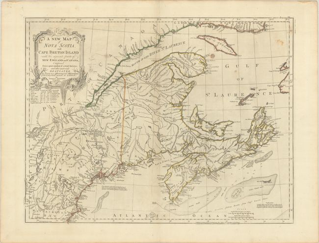
“A New Map of Nova Scotia, and Cape Breton Island with the Adjacent Parts of New England and Canada, Composed from a Great Number of Actual Survey...”
Map Maker:
Jefferys/Sayer & Bennett
Fourth state of this long-lived map, first issued ... (full text available to subscribers)
| Item Detail |
| |
| |
MapMaker: |
Jefferys/Sayer & Bennett
|
|
| |
| |
Subject: |
Colonial Northeastern United States & Canada |
|
| |
Period/Size: |
1775 / 18.6" x 24.3" (47.3 x 61.8 cm)
|
|
| |
Color: |
Colored
|
|
| |
Condition: |
(B+) Contemporary outline color on a sturdy sheet with a large fleur-de-lis coat of arms watermark. There are some minor spots in the image and faint toning along the centerfold. (condition help) |
|
| |
Source: |
The American Atlas |
|
| |
References: |
Kershaw #745; McCorkle #775.8; Sellers and Van Ee #309. |
|
| |
|
|
| Sales Information |
| |
| |
Price: |
|
|
| |
| |
Offered by: |
Old World Auctions |
|
| |
Catalog: |
Auction No. 187 - Antique Maps, Charts, Atlases & Globes (9557) |
|
| |
Lot/Item #: |
128 |
|
| |
| |
Date: |
02/2022
|
|
| |
| |
|
Antique Maps - Valuation and Pricing, Descriptions, Resources |
|
Home |
Information |
Search |
Register |
Contact Us |
Site Map
Americana Exchange, Inc. © 1999 - 2024 Americana Exchange, Inc.. All rights reserved.
OldMaps.com, the OldMaps.com logo and
AMPR are service marks or registered service marks of Americana Exchange, Inc..
|