Title:
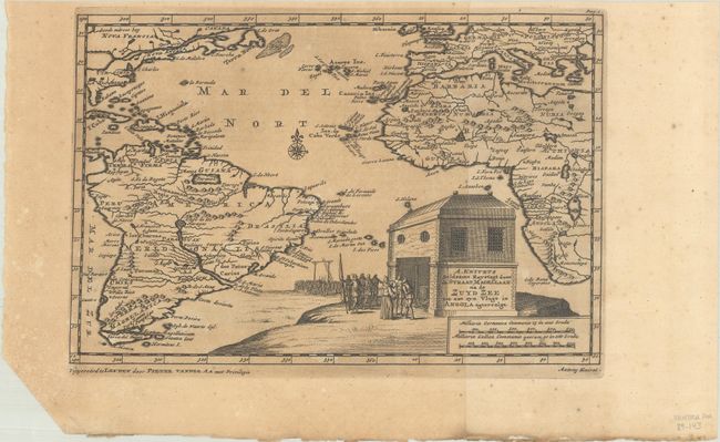
“A. Knivets Zeldzame Reystogt door de Straat Magellaan na de Zuyd Zee tot aan ayn Vlugt in Angola Agtervolgt”
Map Maker:
Pieter van der Aa
This map of the Atlantic Ocean depicts the areas e... (full text available to subscribers)
| Item Detail |
| |
| |
MapMaker: |
Pieter van der Aa
|
|
| |
| |
Subject: |
Atlantic Ocean |
|
| |
Period/Size: |
1710 / 6.0" x 9.1" (15.3 x 23.2 cm)
|
|
| |
Color: |
Black & White
|
|
| |
Condition: |
(B) A dark impression with moderate toning that affects the left 2/3 of the map and scattered foxing confined to the blank margins. The bottom left corner of the sheet has been trimmed, well away from the image. (condition help) |
|
| |
Source: |
Cartes des Iteneraires et Voyages Modernes |
|
| |
References: |
|
|
| |
|
|
| Sales Information |
| |
| |
Price: |
|
|
| |
| |
Offered by: |
Old World Auctions |
|
| |
Catalog: |
Auction No. 188 - Antique Maps, Charts, Atlases & Globes (9558) |
|
| |
Lot/Item #: |
335 |
|
| |
| |
Date: |
04/2022
|
|
| |
| |
|
Antique Maps - Valuation and Pricing, Descriptions, Resources |
|
Home |
Information |
Search |
Register |
Contact Us |
Site Map
Americana Exchange, Inc. © 1999 - 2024 Americana Exchange, Inc.. All rights reserved.
OldMaps.com, the OldMaps.com logo and
AMPR are service marks or registered service marks of Americana Exchange, Inc..
|