Title:
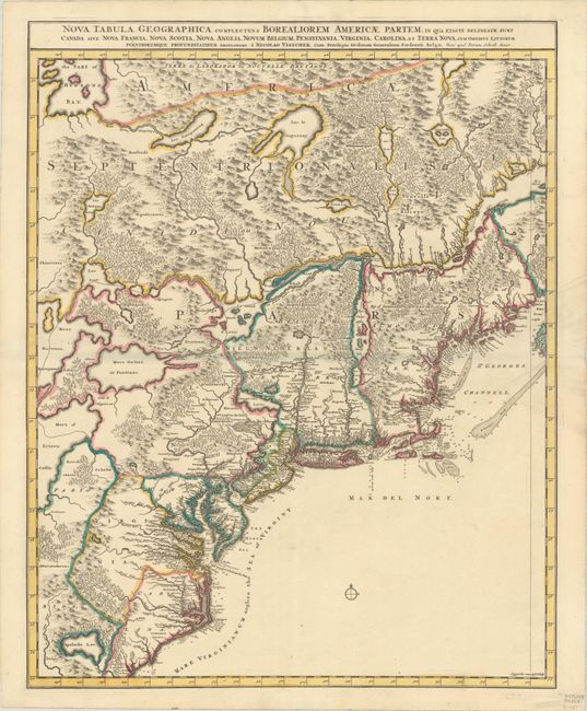
“Nova Tabula Geographica Complectens Borealiorem Americae Partem; in qua Exacte Delineatae sunt Canada sive Nova Francia, Nova Scotia, Nova Anglia, Novum Belgium, Pensylvania, Virginia, Carolina, et Terra Nova...”
Map Maker:
Visscher/Shenk
This attractive and detailed map of the northeast ... (full text available to subscribers)
| Item Detail |
| |
| |
MapMaker: |
Visscher/Shenk
|
|
| |
| |
Subject: |
Colonial Northeastern United States & Canada |
|
| |
Period/Size: |
1717 / 23.4" x 18.6" (59.5 x 47.3 cm)
|
|
| |
Color: |
Colored
|
|
| |
Condition: |
(B+) A crisp impression with contemporary outline color. There are two 2.75" tears adjacent to the centerfold at right that have been archivally repaired with old paper on verso. (condition help) |
|
| |
Source: |
|
|
| |
References: |
Burden #731; McCorkle #689.8. |
|
| |
|
|
| Sales Information |
| |
| |
Price: |
|
|
| |
| |
Offered by: |
Old World Auctions |
|
| |
Catalog: |
Auction No. 188 - Antique Maps, Charts, Atlases & Globes (9558) |
|
| |
Lot/Item #: |
109 |
|
| |
| |
Date: |
04/2022
|
|
| |
| |
|
Antique Maps - Valuation and Pricing, Descriptions, Resources |
|
Home |
Information |
Search |
Register |
Contact Us |
Site Map
Americana Exchange, Inc. © 1999 - 2024 Americana Exchange, Inc.. All rights reserved.
OldMaps.com, the OldMaps.com logo and
AMPR are service marks or registered service marks of Americana Exchange, Inc..
|