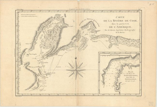
Title:
“Carte de la Riviere de Cook dans la Partie N.O. de l'Amerique”
Map Maker:
Rigobert Bonne
This handsome map shows Capt. Cook's discoveries i... (full text available to subscribers)
| Item Detail |
| |
| |
MapMaker: |
Rigobert Bonne
|
|
| |
| |
Subject: |
Southern Alaska |
|
| |
Period/Size: |
1787 / 9.3" x 13.6" (23.7 x 34.6 cm)
|
|
| |
Color: |
Black & White
|
|
| |
Condition: |
(B+) Issued on watermarked paper with minor toning along the centerfold and a few spots of foxing. There are remnants of hinge tape on verso. (condition help) |
|
| |
Source: |
Atlas Encyclopedique |
|
| |
References: |
|
|
| |
|
|
| Sales Information |
| |
| |
Price: |
|
|
| |
| |
Offered by: |
Old World Auctions |
|
| |
Catalog: |
Auction No. 188 - Antique Maps, Charts, Atlases & Globes (9558) |
|
| |
Lot/Item #: |
181 |
|
| |
| |
Date: |
04/2022
|
|
| |
| |
|
Antique Maps - Valuation and Pricing, Descriptions, Resources |
|
Home |
Information |
Search |
Register |
Contact Us |
Site Map
Americana Exchange, Inc. © 1999 - 2024 Americana Exchange, Inc.. All rights reserved.
OldMaps.com, the OldMaps.com logo and
AMPR are service marks or registered service marks of Americana Exchange, Inc..
|