| Item Detail |
| |
| |
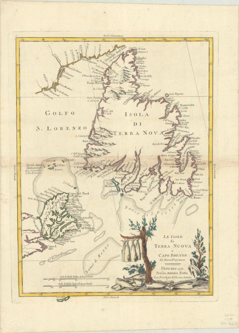
MapMaker: |
Antonio Zatta
|
|
| |
| |
Subject: |
Newfoundland & Cape Breton Island, Canada |
|
| |
Period/Size: |
1778 / 17.1" x 12.6" (43.5 x 32.0 cm)
|
|
| |
Color: |
Colored
|
|
| |
Condition: |
(B+) A strong impression on watermarked paper with three crescent moons. There is some light staining along the centerfold (caused by the adhesive used to attach the backstrap) and some adjacent tiny holes only visible when held to light. (condition help) |
|
| |
Source: |
Atlante Novissimo |
|
| |
References: |
Kershaw #550; Shirley (BL Atlases) T.ZAT-1a Vol. 4 #41. |
|
| |
|
|
| Sales Information |
| |
| |
Price: |
|
|
| |
| |
Offered by: |
Old World Auctions |
|
| |
Catalog: |
Auction No. 188 - Antique Maps, Charts, Atlases & Globes (9558) |
|
| |
Lot/Item #: |
93 |
|
| |
| |
Date: |
04/2022
|
|
| |
| |
|