Title:
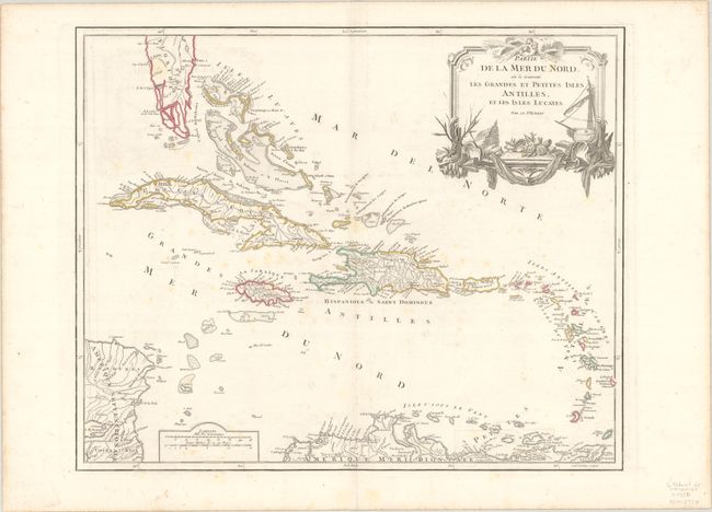
“Partie de la Mer du Nord, ou se Trouvent les Grandes et Petites Isles Antilles, et les Isles Lucayes”
Map Maker:
Gilles Robert de Vaugondy
A large detailed map of the Caribbean extending fr... (full text available to subscribers)
| Item Detail |
| |
| |
MapMaker: |
Gilles Robert de Vaugondy
|
|
| |
| |
Subject: |
Caribbean |
|
| |
Period/Size: |
1750 / 19.1" x 23.6" (48.6 x 60.0 cm)
|
|
| |
Color: |
Colored
|
|
| |
Condition: |
(B+) Contemporary outline color on watermarked paper with light scattered foxing and minor offsetting. (condition help) |
|
| |
Source: |
Atlas Universel |
|
| |
References: |
Pedley #476. |
|
| |
|
|
| Sales Information |
| |
| |
Price: |
|
|
| |
| |
Offered by: |
Old World Auctions |
|
| |
Catalog: |
Auction No. 188 - Antique Maps, Charts, Atlases & Globes (9558) |
|
| |
Lot/Item #: |
272 |
|
| |
| |
Date: |
04/2022
|
|
| |
| |
|
Antique Maps - Valuation and Pricing, Descriptions, Resources |
|
Home |
Information |
Search |
Register |
Contact Us |
Site Map
Americana Exchange, Inc. © 1999 - 2024 Americana Exchange, Inc.. All rights reserved.
OldMaps.com, the OldMaps.com logo and
AMPR are service marks or registered service marks of Americana Exchange, Inc..
|