Title:
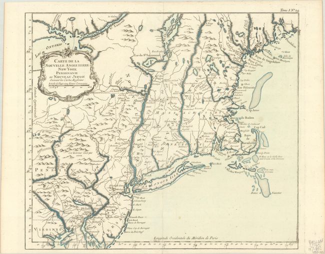
“Carte de la Nouvelle Angleterre New York Pensilvanie et Nouveau Jersay Suivant les Cartes Angloises”
Map Maker:
Jacques Nicolas Bellin
This is the larger version of Bellin's map of New ... (full text available to subscribers)
| Item Detail |
| |
| |
MapMaker: |
Jacques Nicolas Bellin
|
|
| |
| |
Subject: |
Colonial New England & Mid-Atlantic United States |
|
| |
Period/Size: |
1764 / 12.8" x 14.8" (32.6 x 37.6 cm)
|
|
| |
Color: |
Colored
|
|
| |
Condition: |
(A) A clean bright example on watermarked paper with a couple of small, unobtrusive spots. Issued folding. (condition help) |
|
| |
Source: |
Le Petit Atlas Maritime |
|
| |
References: |
McCorkle #764.1; Sellers & Van Ee #723 & 764; Mickwitz & Miekkavaara #10:I [29]; Tooley (MCC-96) #829. |
|
| |
|
|
| Sales Information |
| |
| |
Price: |
|
|
| |
| |
Offered by: |
Old World Auctions |
|
| |
Catalog: |
Auction No. 188 - Antique Maps, Charts, Atlases & Globes (9558) |
|
| |
Lot/Item #: |
146 |
|
| |
| |
Date: |
04/2022
|
|
| |
| |
|
Antique Maps - Valuation and Pricing, Descriptions, Resources |
|
Home |
Information |
Search |
Register |
Contact Us |
Site Map
Americana Exchange, Inc. © 1999 - 2024 Americana Exchange, Inc.. All rights reserved.
OldMaps.com, the OldMaps.com logo and
AMPR are service marks or registered service marks of Americana Exchange, Inc..
|