| Item Detail |
| |
| |
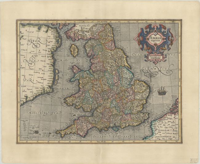
MapMaker: |
Mercator/Hondius
|
|
| |
| |
Subject: |
England & Wales |
|
| |
Period/Size: |
1609 / 13.8" x 18.4" (35.1 x 46.8 cm)
|
|
| |
Color: |
Colored
|
|
| |
Condition: |
(A) A sharp impression on a sheet with a coat of arms watermark. There is a short centerfold separation in the bottom blank margin that has been professionally repaired on verso. (condition help) |
|
| |
Source: |
|
|
| |
References: |
Shirley (BI to 1650) #181; Van der Krogt (Vol. I) #5100:1A.1. |
|
| |
|
|
| Sales Information |
| |
| |
Price: |
|
|
| |
| |
Offered by: |
Old World Auctions |
|
| |
Catalog: |
Auction No. 188 - Antique Maps, Charts, Atlases & Globes (9558) |
|
| |
Lot/Item #: |
378 |
|
| |
| |
Date: |
04/2022
|
|
| |
| |
|