Title:
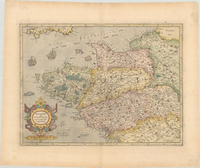
“Britannia & Normandia cum Confinib Regionibus”
Map Maker:
Mercator/Hondius
This is a fine early map of Brittany and Normandy ... (full text available to subscribers)
| Item Detail |
| |
| |
MapMaker: |
Mercator/Hondius
|
|
| |
| |
Subject: |
Northwestern France |
|
| |
Period/Size: |
1628 / 13.8" x 18.4" (35.1 x 46.8 cm)
|
|
| |
Color: |
Colored
|
|
| |
Condition: |
(A) On watermarked paper with a short edge tear in the right blank margin that has been repaired with archival tape on recto and a pair of wormtracks along the bottom edge of the sheet. (condition help) |
|
| |
Source: |
|
|
| |
References: |
Van der Krogt (Vol. I) #4001:1. |
|
| |
|
|
| Sales Information |
| |
| |
Price: |
|
|
| |
| |
Offered by: |
Old World Auctions |
|
| |
Catalog: |
Auction No. 188 - Antique Maps, Charts, Atlases & Globes (9558) |
|
| |
Lot/Item #: |
441 |
|
| |
| |
Date: |
04/2022
|
|
| |
| |
|
Antique Maps - Valuation and Pricing, Descriptions, Resources |
|
Home |
Information |
Search |
Register |
Contact Us |
Site Map
Americana Exchange, Inc. © 1999 - 2024 Americana Exchange, Inc.. All rights reserved.
OldMaps.com, the OldMaps.com logo and
AMPR are service marks or registered service marks of Americana Exchange, Inc..
|