Title:
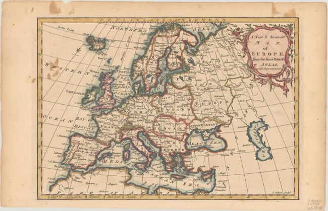
“A New & Accurate Map, of Europe, from the Sieur Robert's Atlas, with Improvements”
Map Maker:
John Gibson
A well-engraved map depicting all of Europe, Icela... (full text available to subscribers)
| Item Detail |
| |
| |
MapMaker: |
John Gibson
|
|
| |
| |
Subject: |
Europe |
|
| |
Period/Size: |
1764 / 8.0" x 11.4" (20.4 x 29.0 cm)
|
|
| |
Color: |
Colored
|
|
| |
Condition: |
(B+) There is some staining adjacent to the left border and in the top blank margin. A short edge tear confined to the top blank margin has been closed on verso with archival tape. (condition help) |
|
| |
Source: |
A New System of Geography... |
|
| |
References: |
McCorkle (18th C. Geography Books) #104-1 (Volume II). |
|
| |
|
|
| Sales Information |
| |
| |
Price: |
|
|
| |
| |
Offered by: |
Old World Auctions |
|
| |
Catalog: |
Auction No. 188 - Antique Maps, Charts, Atlases & Globes (9558) |
|
| |
Lot/Item #: |
355 |
|
| |
| |
Date: |
04/2022
|
|
| |
| |
|
Antique Maps - Valuation and Pricing, Descriptions, Resources |
|
Home |
Information |
Search |
Register |
Contact Us |
Site Map
Americana Exchange, Inc. © 1999 - 2024 Americana Exchange, Inc.. All rights reserved.
OldMaps.com, the OldMaps.com logo and
AMPR are service marks or registered service marks of Americana Exchange, Inc..
|