Title:
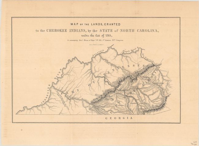
“Map of the Lands, Granted to the Cherokee Indians, by the State of North Carolina, Under the Act of 1783...”
Map Maker:
U.S. Gov.
This small map shows the Cherokee lands of western... (full text available to subscribers)
| Item Detail |
| |
| |
MapMaker: |
U.S. Gov.
|
|
| |
| |
Subject: |
Western North Carolina |
|
| |
Period/Size: |
1846 / 6.3" x 9.9" (16.0 x 25.2 cm)
|
|
| |
Color: |
Black & White
|
|
| |
Condition: |
(B+) Issued folding with minor toning and a few spots of foxing. (condition help) |
|
| |
Source: |
H.R. Doc. 185, 29th Congress, 1st Session |
|
| |
References: |
|
|
| |
|
|
| Sales Information |
| |
| |
Price: |
|
|
| |
| |
Offered by: |
Old World Auctions |
|
| |
Catalog: |
Auction No. 188 - Antique Maps, Charts, Atlases & Globes (9558) |
|
| |
Lot/Item #: |
230 |
|
| |
| |
Date: |
04/2022
|
|
| |
| |
|
Antique Maps - Valuation and Pricing, Descriptions, Resources |
|
Home |
Information |
Search |
Register |
Contact Us |
Site Map
Americana Exchange, Inc. © 1999 - 2024 Americana Exchange, Inc.. All rights reserved.
OldMaps.com, the OldMaps.com logo and
AMPR are service marks or registered service marks of Americana Exchange, Inc..
|