Title:
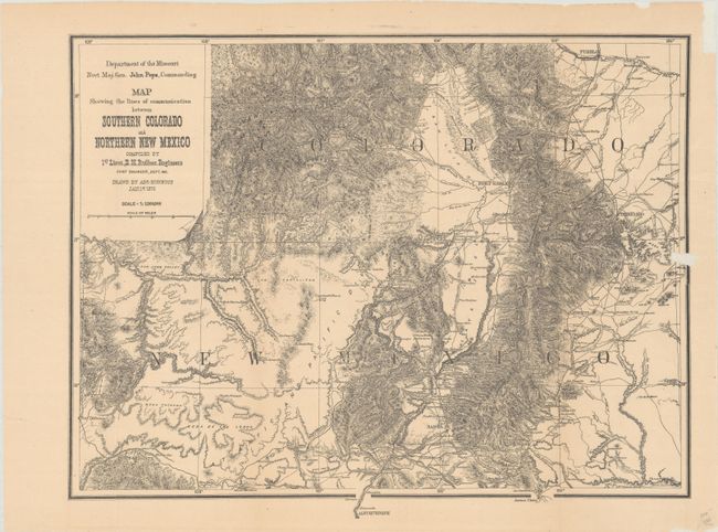
“Map Showing the Lines of Communication Between Southern Colorado and Northern New Mexico”
Map Maker:
Lt. E.H. Ruffner
This map depicts the region from Pueblo south to A... (full text available to subscribers)
| Item Detail |
| |
| |
MapMaker: |
Lt. E.H. Ruffner
|
|
| |
| |
Subject: |
Colorado & New Mexico |
|
| |
Period/Size: |
1876 / 14.6" x 18.6" (37.1 x 47.3 cm)
|
|
| |
Color: |
Black & White
|
|
| |
Condition: |
(B+) Issued folding with archival repairs to a small chip along the right border and several small fold separations at right. (condition help) |
|
| |
Source: |
|
|
| |
References: |
|
|
| |
|
|
| Sales Information |
| |
| |
Price: |
|
|
| |
| |
Offered by: |
Old World Auctions |
|
| |
Catalog: |
Auction No. 188 - Antique Maps, Charts, Atlases & Globes (9558) |
|
| |
Lot/Item #: |
180 |
|
| |
| |
Date: |
04/2022
|
|
| |
| |
|
Antique Maps - Valuation and Pricing, Descriptions, Resources |
|
Home |
Information |
Search |
Register |
Contact Us |
Site Map
Americana Exchange, Inc. © 1999 - 2024 Americana Exchange, Inc.. All rights reserved.
OldMaps.com, the OldMaps.com logo and
AMPR are service marks or registered service marks of Americana Exchange, Inc..
|