Title:
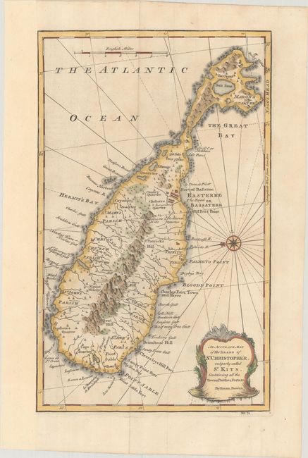
“An Accurate Map of the Island of St. Christopher, Vulgarly Called St. Kitts, Containing All the Towns, Parishes, Forts &c.”
Map Maker:
Emanuel Bowen
This detailed map of St. Kitts is oriented with ea... (full text available to subscribers)
| Item Detail |
| |
| |
MapMaker: |
Emanuel Bowen
|
|
| |
| |
Subject: |
St. Kitts |
|
| |
Period/Size: |
1747 / 13.9" x 8.6" (35.3 x 21.9 cm)
|
|
| |
Color: |
Colored
|
|
| |
Condition: |
(B+) A nice impression on a sheet that has been professionally remargined at left. There is minor soiling and a few separations along the plate mark in the bottom blank margin. (condition help) |
|
| |
Source: |
A Complete System of Geography… |
|
| |
References: |
McCorkle (18th C. Geography Books) #17-34 (Vol II); cf Shirley (BL Atlases) T.BOW-2a #64. |
|
| |
|
|
| Sales Information |
| |
| |
Price: |
|
|
| |
| |
Offered by: |
Old World Auctions |
|
| |
Catalog: |
Auction No. 188 - Antique Maps, Charts, Atlases & Globes (9558) |
|
| |
Lot/Item #: |
290 |
|
| |
| |
Date: |
04/2022
|
|
| |
| |
|
Antique Maps - Valuation and Pricing, Descriptions, Resources |
|
Home |
Information |
Search |
Register |
Contact Us |
Site Map
Americana Exchange, Inc. © 1999 - 2024 Americana Exchange, Inc.. All rights reserved.
OldMaps.com, the OldMaps.com logo and
AMPR are service marks or registered service marks of Americana Exchange, Inc..
|