Title:
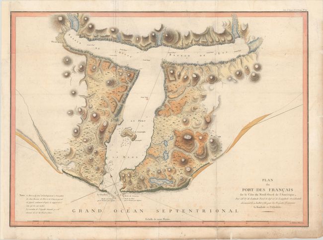
“Plan du Port des Francais sur la Cote du Nord-Ouest de l'Amerique, par 58° 37' de Latitude Nord et 139° 50' de Longitude Occidentale Decouvert le 2 Juillet 1786, par les Fregates Francaise la Boussole et l'Astrolabe”
Map Maker:
Jean Francois Galoup, Comte La Perouse
Fine, large chart of Lituya Bay, located within Gl... (full text available to subscribers)
| Item Detail |
| |
| |
MapMaker: |
Jean Francois Galoup, Comte La Perouse
|
|
| |
| |
Subject: |
Southeastern Alaska |
|
| |
Period/Size: |
1797 / 19.7" x 27.3" (50.1 x 69.4 cm)
|
|
| |
Color: |
Colored
|
|
| |
Condition: |
(B) A dark impression, issued folding on paper with a rosary beads watermark with the initials "RP" and "FR." There is light dampstaining at bottom left and top right, scattered foxing, and light soiling. A few edge tears in the margins have been archiv (condition help) |
|
| |
Source: |
Atlas du Voyage de la Perouse |
|
| |
References: |
Falk #1797-11; Wagner #842; Shirley (BL Atlases) G.LPR-1a #19. |
|
| |
|
|
| Sales Information |
| |
| |
Price: |
|
|
| |
| |
Offered by: |
Old World Auctions |
|
| |
Catalog: |
Auction No. 188 - Antique Maps, Charts, Atlases & Globes (9558) |
|
| |
Lot/Item #: |
182 |
|
| |
| |
Date: |
04/2022
|
|
| |
| |
|
Antique Maps - Valuation and Pricing, Descriptions, Resources |
|
Home |
Information |
Search |
Register |
Contact Us |
Site Map
Americana Exchange, Inc. © 1999 - 2024 Americana Exchange, Inc.. All rights reserved.
OldMaps.com, the OldMaps.com logo and
AMPR are service marks or registered service marks of Americana Exchange, Inc..
|