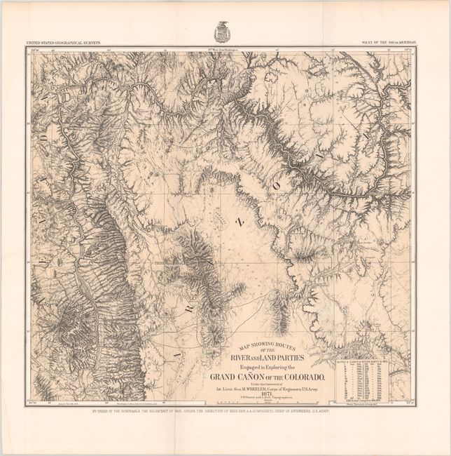
Title:
“Map Showing Routes of the River and Land Parties Engaged in Exploring the Grand Canon of the Coloradoģ”
Map Maker:
Lt. George M. Wheeler
This is the map of Wheeler's epic journey in 1871 ... (full text available to subscribers)
| Item Detail |
| |
| |
MapMaker: |
Lt. George M. Wheeler
|
|
| |
| |
Subject: |
Grand Canyon, Arizona |
|
| |
Period/Size: |
1871 / 15.0" x 16.3" (38.1 x 41.4 cm)
|
|
| |
Color: |
Black & White
|
|
| |
Condition: |
(A) Issued folding on a clean sturdy sheet with one short fold separation that has been closed on verso with archival tape. (condition help) |
|
| |
Source: |
United States Geographical Surveys |
|
| |
References: |
Wheat (TMW) #1292. |
|
| |
|
|
| Sales Information |
| |
| |
Price: |
|
|
| |
| |
Offered by: |
Old World Auctions |
|
| |
Catalog: |
Auction No. 188 - Antique Maps, Charts, Atlases & Globes (9558) |
|
| |
Lot/Item #: |
184 |
|
| |
| |
Date: |
04/2022
|
|
| |
| |
|
Antique Maps - Valuation and Pricing, Descriptions, Resources |
|
Home |
Information |
Search |
Register |
Contact Us |
Site Map
Americana Exchange, Inc. © 1999 - 2024 Americana Exchange, Inc.. All rights reserved.
OldMaps.com, the OldMaps.com logo and
AMPR are service marks or registered service marks of Americana Exchange, Inc..
|