| Item Detail |
| |
| |
MapMaker: |
(none given)
|
|
| |
| |
Subject: |
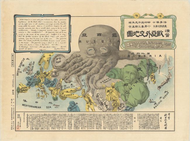
Persuasive Maps, Russo-Japanese War |
|
| |
Period/Size: |
1904 / 16.4" x 22.8" (41.7 x 58.0 cm)
|
|
| |
Color: |
Colored
|
|
| |
Condition: |
(A) A clean and bright example, issued folding and now flattened and professionally backed in thin, archival tissue to repair a couple of tiny holes and a short tear in the right margin. (condition help) |
|
| |
Source: |
|
|
| |
References: |
PJ Mode Collection #1145; Baynton-Williams (The Curious Map Book) pp. 196-97. |
|
| |
|
|
| Sales Information |
| |
| |
Price: |
|
|
| |
| |
Offered by: |
Old World Auctions |
|
| |
Catalog: |
Auction No. 188 - Antique Maps, Charts, Atlases & Globes (9558) |
|
| |
Lot/Item #: |
50 |
|
| |
| |
Date: |
04/2022
|
|
| |
| |
|