| Item Detail |
| |
| |
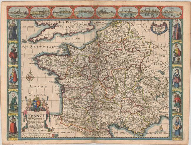
MapMaker: |
John Speed
|
|
| |
| |
Subject: |
France |
|
| |
Period/Size: |
1676 / 15.8" x 20.4" (40.2 x 51.9 cm)
|
|
| |
Color: |
Colored
|
|
| |
Condition: |
(B+) On watermarked paper with a Strasbourg bend watermark. There is light offsetting along the centerfold and a few tiny holes only visible when held to light. Several centerfold separations as well as an edge tear at bottom have all been archivally re (condition help) |
|
| |
Source: |
A Prospect of the Most Famous Parts of the World… |
|
| |
References: |
Shirley (BL Atlases) T.SPE-1j. |
|
| |
|
|
| Sales Information |
| |
| |
Price: |
|
|
| |
| |
Offered by: |
Old World Auctions |
|
| |
Catalog: |
Auction No. 189 - Antique Maps, Charts, Atlases & Globes (9559) |
|
| |
Lot/Item #: |
438 |
|
| |
| |
Date: |
09/2022
|
|
| |
| |
|