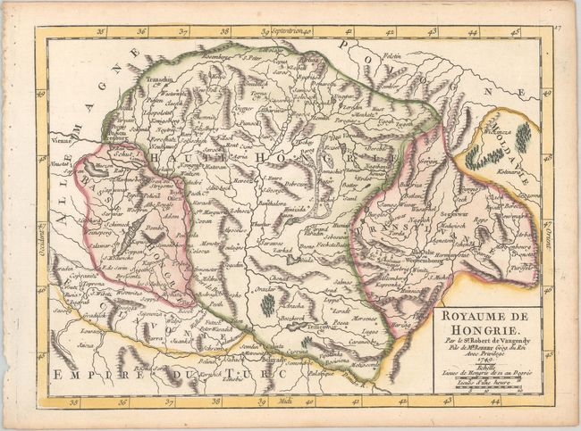
Title:
“Royaume de Hongrie”
Map Maker:
Didier Robert de Vaugondy
This map depicts Hungary, Romania, and northern Se... (full text available to subscribers)
| Item Detail |
| |
| |
MapMaker: |
Didier Robert de Vaugondy
|
|
| |
| |
Subject: |
Southeastern Europe, Hungary |
|
| |
Period/Size: |
1749 / 6.5" x 8.8" (16.6 x 22.4 cm)
|
|
| |
Color: |
Colored
|
|
| |
Condition: |
(A) A nice impression on a watermarked sheet with light toning along the edges. (condition help) |
|
| |
Source: |
Atlas Portatif Universel et Militaire |
|
| |
References: |
Pedley #287. |
|
| |
|
|
| Sales Information |
| |
| |
Price: |
|
|
| |
| |
Offered by: |
Old World Auctions |
|
| |
Catalog: |
Auction No. 189 - Antique Maps, Charts, Atlases & Globes (9559) |
|
| |
Lot/Item #: |
511 |
|
| |
| |
Date: |
09/2022
|
|
| |
| |
|
Antique Maps - Valuation and Pricing, Descriptions, Resources |
|
Home |
Information |
Search |
Register |
Contact Us |
Site Map
Americana Exchange, Inc. © 1999 - 2024 Americana Exchange, Inc.. All rights reserved.
OldMaps.com, the OldMaps.com logo and
AMPR are service marks or registered service marks of Americana Exchange, Inc..
|