Title:
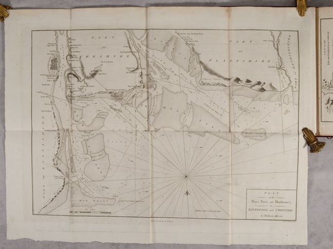
“Plans of the Principal Harbours, Bays, & Roads, in St. George's and the Bristol Channels, from Surveys Made Under the Direction of the Lords of the Admiralty...”
This volume containing charts primarily of the coa... (full text available to subscribers)
| Item Detail |
| |
| |
MapMaker: |
(none given)
|
|
| |
| |
Subject: |
Wales, England & Ireland |
|
| |
Period/Size: |
1801 / 11.9" x 8.6" (30.3 x 21.9 cm)
|
|
| |
Color: |
Black & White
|
|
| |
Condition: |
(A) Contents are mostly clean and bright with occasional minor foxing and offsetting. A former owner's bookplate is on the front pastedown. Covers are lightly worn with bumped edges. (condition help) |
|
| |
Source: |
|
|
| |
References: |
|
|
| |
|
|
| Sales Information |
| |
| |
Price: |
|
|
| |
| |
Offered by: |
Old World Auctions |
|
| |
Catalog: |
Auction No. 189 - Antique Maps, Charts, Atlases & Globes (9559) |
|
| |
Lot/Item #: |
392 |
|
| |
| |
Date: |
09/2022
|
|
| |
| |
|
Antique Maps - Valuation and Pricing, Descriptions, Resources |
|
Home |
Information |
Search |
Register |
Contact Us |
Site Map
Americana Exchange, Inc. © 1999 - 2024 Americana Exchange, Inc.. All rights reserved.
OldMaps.com, the OldMaps.com logo and
AMPR are service marks or registered service marks of Americana Exchange, Inc..
|