| Item Detail |
| |
| |
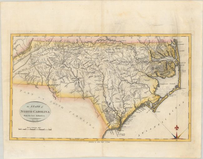
MapMaker: |
John Reid
|
|
| |
| |
Subject: |
North Carolina |
|
| |
Period/Size: |
1796 / 10.9" x 18.3" (27.7 x 46.5 cm)
|
|
| |
Color: |
Colored
|
|
| |
Condition: |
(A) A nice impression on a sheet with the watermarks of "J. Kool" and a fleur-de-lis coat of arms. There is some light printer's ink residue and faint dampstain confined to the top blank margin. (condition help) |
|
| |
Source: |
The American Atlas |
|
| |
References: |
Wheat & Brun #587; Phillips (Atlases) #1216-16. |
|
| |
|
|
| Sales Information |
| |
| |
Price: |
|
|
| |
| |
Offered by: |
Old World Auctions |
|
| |
Catalog: |
Auction No. 189 - Antique Maps, Charts, Atlases & Globes (9559) |
|
| |
Lot/Item #: |
254 |
|
| |
| |
Date: |
09/2022
|
|
| |
| |
|