| Item Detail |
| |
| |
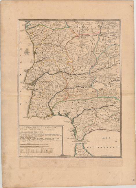
MapMaker: |
Nicholas de Fer
|
|
| |
| |
Subject: |
Spain & Portugal |
|
| |
Period/Size: |
1705 / 22.6" x 16.9" (57.4 x 43.0 cm)
|
|
| |
Color: |
Colored
|
|
| |
Condition: |
(B) Contemporary outline color on a lightly toned sheet with wide margins and the watermark of the Maltese cross encircled by rosary beads. There is light offsetting, a few printer's creases, and minor soiling. (condition help) |
|
| |
Source: |
Atlas ou Recueil de Cartes Geographiquesģ |
|
| |
References: |
Pastoureau, FER II C [72]. |
|
| |
|
|
| Sales Information |
| |
| |
Price: |
|
|
| |
| |
Offered by: |
Old World Auctions |
|
| |
Catalog: |
Auction No. 189 - Antique Maps, Charts, Atlases & Globes (9559) |
|
| |
Lot/Item #: |
458 |
|
| |
| |
Date: |
09/2022
|
|
| |
| |
|