Title:
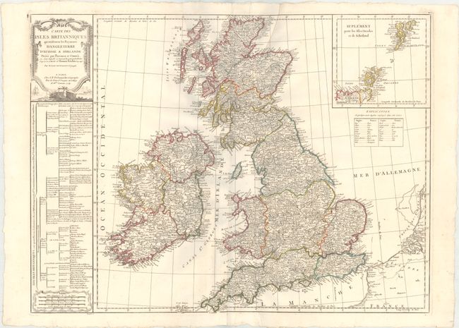
“Carte des Isles Britanniques qui Renferment les Royaumes d'Angleterre d'Ecosse & d'Irlande...”
Map Maker:
Robert de Vaugondy/Delamarche
This fine, large-scale map of the British Isles cr... (full text available to subscribers)
| Item Detail |
| |
| |
MapMaker: |
Robert de Vaugondy/Delamarche
|
|
| |
| |
Subject: |
Britain |
|
| |
Period/Size: |
1789 / 21.3" x 28.3" (54.1 x 71.9 cm)
|
|
| |
Color: |
Colored
|
|
| |
Condition: |
(A) A crisp impression with contemporary outline color on a sheet with the watermark of the Maltese cross encircled by rosary beads. There is some minor extraneous creasing at the top of the map. (condition help) |
|
| |
Source: |
|
|
| |
References: |
|
|
| |
|
|
| Sales Information |
| |
| |
Price: |
|
|
| |
| |
Offered by: |
Old World Auctions |
|
| |
Catalog: |
Auction No. 189 - Antique Maps, Charts, Atlases & Globes (9559) |
|
| |
Lot/Item #: |
373 |
|
| |
| |
Date: |
09/2022
|
|
| |
| |
|
Antique Maps - Valuation and Pricing, Descriptions, Resources |
|
Home |
Information |
Search |
Register |
Contact Us |
Site Map
Americana Exchange, Inc. © 1999 - 2024 Americana Exchange, Inc.. All rights reserved.
OldMaps.com, the OldMaps.com logo and
AMPR are service marks or registered service marks of Americana Exchange, Inc..
|