| Item Detail |
| |
| |
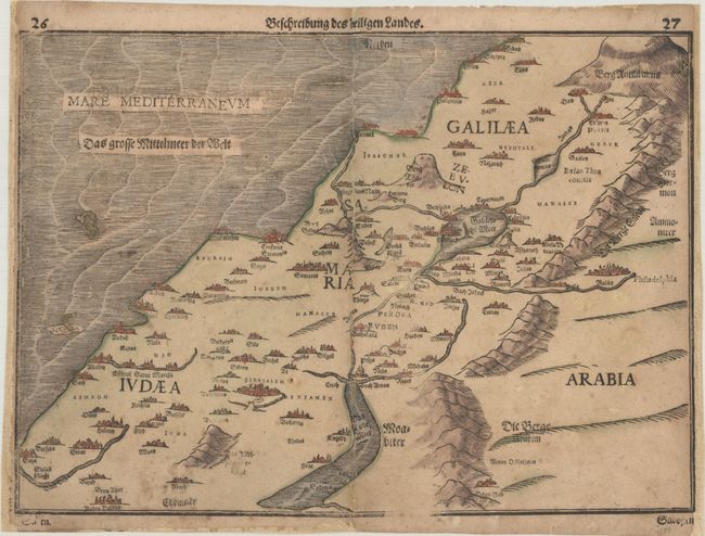
MapMaker: |
Heinrich Bunting
|
|
| |
| |
Subject: |
Holy Land |
|
| |
Period/Size: |
1600 / 10.5" x 14.8" (26.7 x 37.6 cm)
|
|
| |
Color: |
Colored
|
|
| |
Condition: |
(B) On a lightly toned sheet with some soiling. There are professional repairs to some separations and small holes along the centerfold, and to a chip in the bottom blank margin. Remargined at right and left to accommodate framing. (condition help) |
|
| |
Source: |
Itinerarium Sacrae Scripturae |
|
| |
References: |
Laor #141. |
|
| |
|
|
| Sales Information |
| |
| |
Price: |
|
|
| |
| |
Offered by: |
Old World Auctions |
|
| |
Catalog: |
Auction No. 189 - Antique Maps, Charts, Atlases & Globes (9559) |
|
| |
Lot/Item #: |
561 |
|
| |
| |
Date: |
09/2022
|
|
| |
| |
|