| Item Detail |
| |
| |
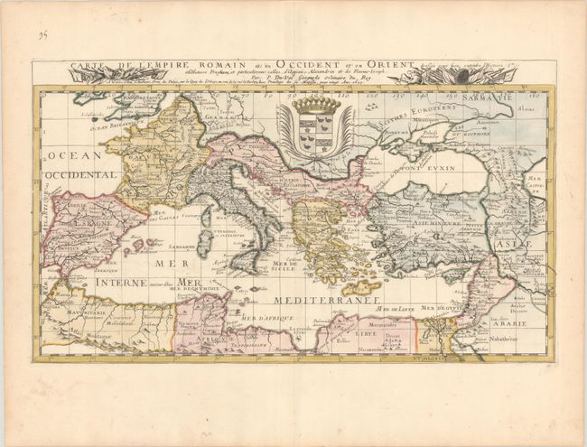
MapMaker: |
Pierre DuVal
|
|
| |
| |
Subject: |
Mediterranean & Southern Europe |
|
| |
Period/Size: |
1677 / 12.8" x 22.0" (32.6 x 55.9 cm)
|
|
| |
Color: |
Colored
|
|
| |
Condition: |
(A) A crisp impression on a sheet with the Society of Jesus watermark and marginal soiling. (condition help) |
|
| |
Source: |
Cartes de Geographie les Plus Nouvelles et les Plus Fideles... |
|
| |
References: |
Pastoureau, DUVAL II F [112]. |
|
| |
|
|
| Sales Information |
| |
| |
Price: |
|
|
| |
| |
Offered by: |
Old World Auctions |
|
| |
Catalog: |
Auction No. 189 - Antique Maps, Charts, Atlases & Globes (9559) |
|
| |
Lot/Item #: |
536 |
|
| |
| |
Date: |
09/2022
|
|
| |
| |
|