| Item Detail |
| |
| |
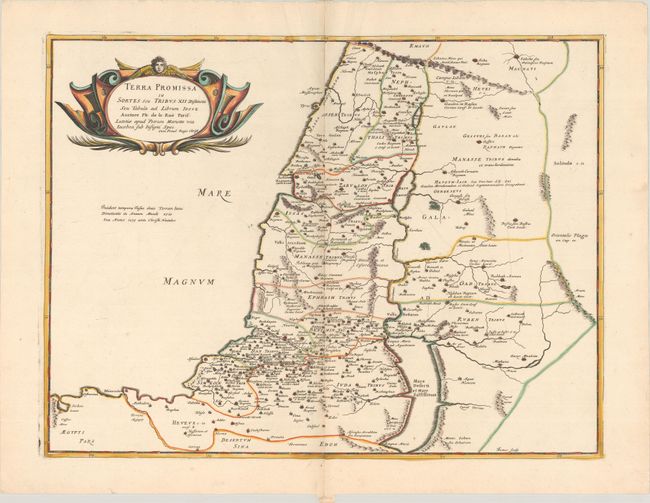
MapMaker: |
Philippe de la Rue
|
|
| |
| |
Subject: |
Holy Land |
|
| |
Period/Size: |
1667 / 15.8" x 20.8" (40.2 x 52.9 cm)
|
|
| |
Color: |
Colored
|
|
| |
Condition: |
(A) A sharp impression on a bright sheet with the watermarks of the initials "B[heart]C" and a large coat of arms watermark, with contemporary outline color in the map and later color in the cartouche. There are two small worm holes along the centerfold (condition help) |
|
| |
Source: |
La Terre Sainte en Six Cartes Geographiques |
|
| |
References: |
Laor #416; Pastoureau, LA RUE [2]. |
|
| |
|
|
| Sales Information |
| |
| |
Price: |
|
|
| |
| |
Offered by: |
Old World Auctions |
|
| |
Catalog: |
Auction No. 191 - Antique Maps, Charts, Atlases & Globes (9561) |
|
| |
Lot/Item #: |
648 |
|
| |
| |
Date: |
02/2023
|
|
| |
| |
|