Title:
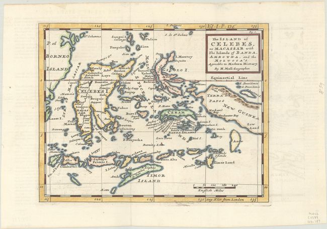
“The Island of Celebes, or Macassar with the Islands of Banda, Amboyna, and the Molucca's. Agreable to Modern History”
Map Maker:
Herman Moll
A finely engraved chart of the East Indies that in... (full text available to subscribers)
| Item Detail |
| |
| |
MapMaker: |
Herman Moll
|
|
| |
| |
Subject: |
East Indies - Indonesia |
|
| |
Period/Size: |
1739 / 7.9" x 10.2" (20.1 x 25.9 cm)
|
|
| |
Color: |
Colored
|
|
| |
Condition: |
(A) Crisp impression on bright sheet of hand laid paper, issued folding with wide margins and a ghost of offsetting. (condition help) |
|
| |
Source: |
Modern History |
|
| |
References: |
McCorkle (18th C. Geography Books) #347, Vol. I [6]. |
|
| |
|
|
| Sales Information |
| |
| |
Price: |
|
|
| |
| |
Offered by: |
Old World Auctions |
|
| |
Catalog: |
Auction No. 191 - Antique Maps, Charts, Atlases & Globes (9561) |
|
| |
Lot/Item #: |
702 |
|
| |
| |
Date: |
02/2023
|
|
| |
| |
|
Antique Maps - Valuation and Pricing, Descriptions, Resources |
|
Home |
Information |
Search |
Register |
Contact Us |
Site Map
Americana Exchange, Inc. © 1999 - 2024 Americana Exchange, Inc.. All rights reserved.
OldMaps.com, the OldMaps.com logo and
AMPR are service marks or registered service marks of Americana Exchange, Inc..
|