Rister or Sign In to see pricing information


Title:

An Improved Map of Palestine, Wherein the Most Recent Information of the Present Geography of the Country...

Map Maker:

John Walker

An Improved Map of Palestine, Wherein the Most Recent Information of the Present Geography of the Country...

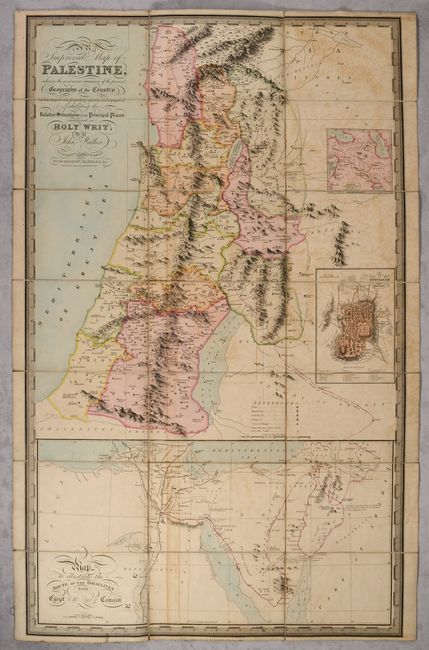
A beautifully engraved and rare map of the Holy La... (full text available to subscribers)
Item Detail
 
  MapMaker:  

John Walker


  Subject:  Holy Land  
  Period/Size:  1836 / 36.7" x 22.8"  (93.3 x 58.0 cm)  
  Color:  Colored  
  Condition:  (B) Dissected and backed with contemporary linen. There is light offsetting and minor soiling. The slipcase is soiled with some wear along the edges. (condition help)  
  Source:   
  References:   
 
 
Sales Information
 
  Price: 

Please register your email to view records, or sign in with email address to see records


  Offered by:  Old World Auctions  
  Catalog:  Auction No. 191 - Antique Maps, Charts, Atlases & Globes (9561)  
  Lot/Item #:  650  
 
  Date:  02/2023  


Antique Maps - Valuation and Pricing, Descriptions, Resources


Home | Information | Search | Register | Contact Us | Site Map

Americana Exchange, Inc. © 1999 - 2024 Americana Exchange, Inc.. All rights reserved. OldMaps.com, the OldMaps.com logo and
AMPR are service marks or registered service marks of Americana Exchange, Inc..