| Item Detail |
| |
| |
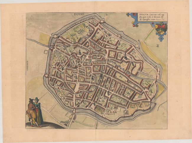
MapMaker: |
Braun & Hogenberg
|
|
| |
| |
Subject: |
Douai, France |
|
| |
Period/Size: |
1582 / 13.1" x 15.8" (33.3 x 40.2 cm)
|
|
| |
Color: |
Colored
|
|
| |
Condition: |
(A) A nice impression on a watermarked sheet with minor toning and two small holes in the image along the centerfold. (condition help) |
|
| |
Source: |
Civitates Orbis Terrarum, Vol. III. |
|
| |
References: |
Fussel, p. 227; Van der Krogt (Vol. IV) #1123. |
|
| |
|
|
| Sales Information |
| |
| |
Price: |
|
|
| |
| |
Offered by: |
Old World Auctions |
|
| |
Catalog: |
Auction No. 191 - Antique Maps, Charts, Atlases & Globes (9561) |
|
| |
Lot/Item #: |
534 |
|
| |
| |
Date: |
02/2023
|
|
| |
| |
|